
The short answer
Google Earth Studio is the better tool when the footage itself is the point. It is Google’s free camera for the real Earth: photorealistic satellite imagery and 3D cities, keyframed like professional motion-design software. Nothing else in this category looks like it.
Mapflyover is the better tool when the map has to explain something, or when the video has to earn money. You write a script, and it builds the video around it: real place boundaries, borders traced, countries filled with a colour, a picture or a flag, routes drawn between places, narration generated in the app, and captions timed to every spoken word. What comes out is a finished MP4, and the exports are 100% yours, including for commercial use.
The honest split is this: Earth Studio makes the camera move over a realistic Earth. Mapflyover makes the map say something. Which one you need depends on what your video is for — and, if you monetise your channel, on a licence detail that matters more than any feature.
Mapflyover vs Google Earth Studio at a glance
| Mapflyover | Google Earth Studio | |
|---|---|---|
| What it is | Map video studio: script to finished MP4 | Camera tool for Google Earth’s satellite and 3D imagery |
| Price | Free plan; Pro $20/month; Studio $70/month | Free, but access is by request |
| Getting started | Sign up in any modern browser, phone or desktop | Request access with a Google account; desktop Chrome only |
| How you build | Scenes, one per place — the camera flies itself | Hand-set keyframes on a timeline, plus quick-start templates |
| Imagery | Map looks (including satellite), real place outlines from OpenStreetMap | Google Earth satellite imagery and photorealistic 3D cities, plus the Moon and Mars |
| Borders, fills, labels | Built in: automatic boundaries, border traces, flag and picture fills, stat cards | Preset map styles; your own shapes as KML; labels and pins added in post-production |
| Routes | Built in: solid, dashed or dotted lines with moving icons | None built in — KML overlays or post-production |
| Narration and captions | Built in and free: 48 voices, word-timed captions in seven looks | None — record and caption in your editor |
| What you get out | Finished MP4, 16:9 or 9:16, up to 4K | Image sequence locally; experimental cloud render gives MP4 |
| Commercial use | Exports 100% yours, commercial use included | No commercial licence offered for the imagery |
| AI help | Built-in draft, or your own AI agent over MCP (Claude, ChatGPT and others) | None — manual keyframes and templates |
Prices and features checked against Mapflyover’s pricing page and Google Earth Studio’s own FAQ on 10 November 2026. Both products change, so check their sites before you decide.
What each tool actually is
Google Earth Studio is, in Google’s own words, an animation tool for Google Earth’s satellite and 3D imagery. You move the globe, set a keyframe, move it again, and set another — the same way motion-design software works. Quick-start templates give you ready camera moves such as an orbit or a fly-to, and you can animate extras such as the sun’s position and the camera’s field of view. It uses the same imagery and 3D engine as Google Earth, so a slow orbit around a mountain or a flyover of Manhattan looks like drone footage.
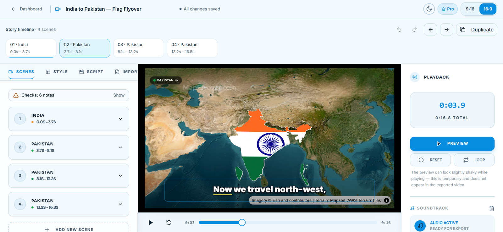
Mapflyover starts from the story instead of the camera. Each place in your script becomes a scene: its real boundary is found and framed automatically, borders are traced, countries are filled with a colour, a picture or the country’s flag, and routes draw themselves between places. Narration is generated in the app from 48 voices, captions are timed to every spoken word, and the result renders in your browser as a finished MP4 in 16:9 or 9:16. If you would rather not build it yourself, you can hand the build to your own AI agent — Claude, ChatGPT or any MCP client can create and preview the video, while the export button stays yours. Our guide to letting an AI agent make your map video walks through the setup.
Put simply: Earth Studio is a camera. Mapflyover is a studio. The camera gives you the most beautiful single shot; the studio gives you a finished video with the explanation already inside it.
Price — and the licence catch
Google Earth Studio costs nothing. There is no paid tier, and its home page says plainly that it is free to use. But the price is not the catch; the licence is. Google’s FAQ states: “We currently do not offer a license to use Google Earth imagery for commercial applications.” Properly attributed content can be used for research, education, film and nonprofit work — but not for ads, promotions, client work or anything else commercial. Attribution to Google Earth and the imagery providers is not optional either: it is generated for every frame and watermarked onto the render.
Mapflyover has a free plan that never expires. The full editor, unlimited previews, narration and captions are free on every plan, and the Free plan includes 3 projects and 2 MP4 exports a month at 720p, up to 90 seconds each, with a small Mapflyover mark. Pro is $20 a month for 30 exports up to 1080p and 5 minutes with no mark, after a $3 seven-day trial. Studio is $70 a month for 300 exports up to 4K and 15 minutes. And Mapflyover’s terms give you 100% ownership of your final MP4 exports for commercial or personal use — yours to monetise, sell or run as an ad.
So the honest comparison is not $0 versus $20. It is a free camera whose footage you may not use commercially, against a studio whose free plan already covers a small channel and whose exports carry no imagery licence at all. If your videos earn money, that difference decides the question before features do.
How you build a video in each
In Earth Studio, you build by hand. Every camera move is a keyframe you set yourself: position the globe, set the keyframe, move, set another, adjust the easing, and repeat. The five quick-start templates help, and the control is genuinely complete — field of view, sun position, camera targets — but a one-minute video is a real editing session, and you should expect to spend 30 to 90 minutes on it, plus the time to finish it in an editor afterwards.
In Mapflyover, you build by scenes. Write the script (or paste one), add a voice, and each place becomes a scene with its outline found and framed for you. The camera rises before it travels, then lands — orbit, push in, drift or sweep while it holds — without you keyframing anything. If a framing looks wrong, you adjust that scene, not a timeline of keyframes. Our step-by-step guide to making a map animation video shows the whole flow.
The trade-off is control against speed. Earth Studio lets you place the camera exactly where you want it, down to the metre and the degree. Mapflyover decides the camera for you and lets you correct it. If you enjoy keyframing, Earth Studio is the more satisfying tool. If you want a video finished today, Mapflyover is the faster one — a short video can go from script to export in minutes.
Imagery: the real Earth vs a map that explains
This is where Earth Studio is genuinely unbeatable. No drawn map matches Google’s photorealistic 3D cities and terrain. A flyover of a real city, a slow orbit around a mountain range, a descent into a valley — Earth Studio does that, and Mapflyover does not. Its satellite look is a map style, not a photograph of the planet, and its 3D is the camera moving over the map rather than through a modelled city.
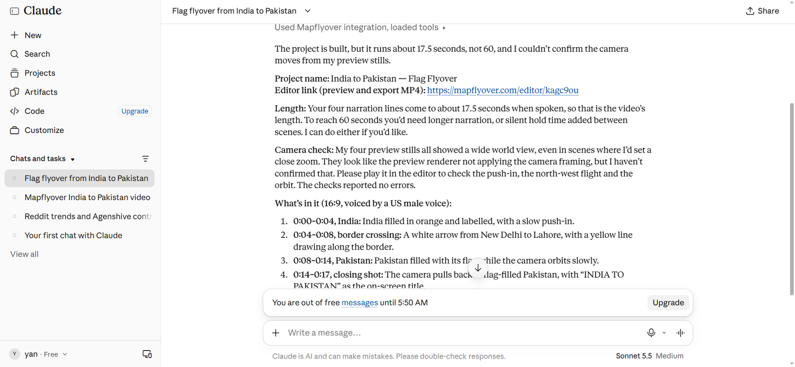
What Mapflyover does instead is explain. Its outlines come from OpenStreetMap, so a country, region, city or landmark is drawn with its real boundary — not an approximation — and the boundary is the thing the video is about. You can trace a border, fill a country with its flag, drop a stat card on cue, and draw a route that moves between places. Earth Studio can show preset borders and labels through its map styles, and you can import your own shapes as KML files, but you cannot animate a border line by line or fill one country after another inside it, and Google’s own site describes labels and pins as something you add in post-production.
So ask what your viewer needs to see. If the shot is “fly between the towers of a real city,” Earth Studio wins outright. If the shot is “show me which countries border Russia, one by one,” Mapflyover wins outright. Most geography and history channels need the second shot far more often than the first.
Narration, captions, fills and routes
This is the widest gap between the two tools, and it is all in Mapflyover’s favour.
Mapflyover generates narration in the app — 48 voices, free, in English, Hindi, Urdu, Spanish and more — and captions are timed to every spoken word by Whisper, in seven looks including karaoke, pop box and cinema. The editor shows a live preview, and the exported video uses the same drawing code, so what you see is what you get. Our guide to adding narration and captions in Mapflyover covers the voices and caption styles in detail.
Earth Studio has none of this. No narration, no captions, no fills, no routes. You record the voice-over yourself, caption it yourself, and add every label, border and route in an editor afterwards — or, if you use After Effects, through its 3D camera export, which sends the camera path to After Effects so labels and pins you add there stay locked to real places. That export is a real strength, but it is still post-production work, and it assumes you own and know After Effects.
The practical effect: a Mapflyover video leaves the tool finished — voice, captions, fills, routes and all. An Earth Studio render leaves the tool as raw footage, and the video is made in the next tool.
Export: what you actually get
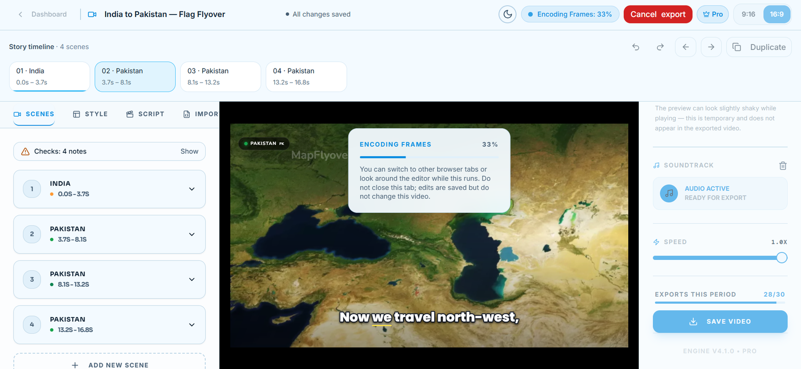
Mapflyover renders a finished MP4 in your browser: 16:9 for YouTube or 9:16 for Shorts, Reels and TikTok, from the same project. Free exports at 720p, Pro up to 1080p, Studio up to 4K. Rendering is frame by frame in the browser, so the time depends on the length, the resolution and your device — and if an export ever stalls, our export troubleshooting guide covers the fixes that work, including the resume behaviour that keeps your progress.
Earth Studio renders locally as an image sequence — a folder of still frames — which you assemble into a video with Adobe Media Encoder or After Effects, as Google’s own docs suggest. Chrome must stay open, with Earth Studio as the focused tab, until the render ends. There is also an experimental cloud render that returns an H.264 MP4, with a daily limit of 18,000 frames (about 10 minutes at 30 fps), but map styles are not supported in cloud renders, and finished cloud renders stay available for 10 days only.
Earth Studio also has two export features Mapflyover does not: the 3D camera export to After Effects mentioned above, and 360° spherical export for VR headsets and YouTube 360 video. If either of those is your project, Earth Studio is the only choice here.
Access and requirements
This is the first real difference, and it matters before you do any work. Earth Studio is a preview with request-based access: its home page asks you to sign in with a Google account to request access, and access is granted case by case — Google emails you whether or not you are accepted. Plan for a wait, and for the chance of a no. It also runs only in desktop Google Chrome on Mac or Windows, needs WebGL and hardware acceleration, and a slow connection makes renders take much longer, because the imagery streams while you render.
Mapflyover has open sign-up: create an account and start on the free plan, with no approval step. It runs in any modern browser, on phone and desktop, and the whole studio — scene editing to export — works on a phone. You can try it in minutes, which is a meaningful difference when you are choosing a tool rather than applying for one.
Who should choose which
Choose Google Earth Studio if:
- The footage has to be the real Earth — photorealistic 3D cities and terrain no drawn map can match.
- You make news, documentary, education or nonprofit work, and can keep the Google Earth credit on screen.
- You already work in After Effects, and want the 3D camera export to add labels and pins that stay locked to the ground.
- You want full manual control of the camera — keyframes, easing, field of view and sun position.
- You need 360° video, or the Moon and Mars. Both are built in.
Choose Mapflyover if:
- Your map has to explain something: borders traced, countries filled — flag, picture or stat — routes drawn on, labels and cards inside the video.
- The video is spoken: narration generated and captions timed to it, not a separate recording and captioning job.
- The video earns money — a monetised channel, client work, an ad — so you need exports you own outright, with no licence hanging over them.
- You want a finished MP4 from any browser, or your own AI agent building the video while you review it.
- You want to start today, without waiting for an access decision.
Use both
These tools also work together, and many creators do exactly that: shoot the realistic flyover of a city or a mountain range in Earth Studio, then make the border, route or label sequence in Mapflyover, and cut the two together in your editor. You get Google’s imagery where it matters and a clear map where the story needs one. Just remember the licence rule follows the Earth Studio footage wherever it goes — the Mapflyover half is yours, the Earth Studio half still is not for commercial use.
Frequently asked questions
Is Google Earth Studio really free?
Yes — free to use, with no paid tier. The catch is access: you request it with a Google account, Google emails you either way, and it runs in desktop Chrome only. Mapflyover’s free plan needs no approval and works in any modern browser.
Can I use Google Earth Studio videos commercially?
Google’s FAQ says it offers no licence for commercial use of Google Earth imagery. With attribution, content can be used for research, education, film and nonprofit work — but not for ads, promotions or client work. Mapflyover’s terms give you 100% ownership of exports for commercial or personal use.
Does Earth Studio export a finished video?
Not locally: a local render is an image sequence, which you turn into a video with an editor such as Adobe Media Encoder or After Effects. The experimental cloud render returns an MP4, but without the map styles — the borders and labels — and keeps files for 10 days only. Mapflyover renders a finished MP4 in your browser.
Which is better for geography and history channels?
Earth Studio gives you the real planet, but the explaining layer — borders, fills, routes, narration, captions — is post work. Mapflyover builds that layer in, voice-over included. Most geography and history videos need the explanation more than the beauty shot, which is why they usually belong in Mapflyover — with Earth Studio kept for the opening shot.
Can Earth Studio highlight a country or trace a border?
Its map styles can show preset borders and labels, and you can import KML shapes and animate their overall opacity. It cannot animate individual KML points, so a line-by-line border trace or a country-by-country fill is easier in Mapflyover, where both are built-in animation types.
Is Mapflyover really free?
Building, previewing, narrating and captioning are free, and the Free plan exports 2 short MP4 videos a month at 720p with a small Mapflyover mark. Pro ($20 a month) and Studio ($70 a month) raise the limits and remove the mark. See Mapflyover’s pricing page for the current numbers.
The bottom line
Google Earth Studio is the right tool for realistic Earth footage. It is free, its imagery is the best available, and its After Effects camera export is a real strength. Its limits are access by request, desktop Chrome only, image sequences to convert, and no commercial licence for the imagery.
Mapflyover is the right tool for a finished map video. It is the faster build, it carries the explaining layer — boundaries, fills, routes, narration, captions — inside the video, and its exports are yours to use however you like. Its limit is the imagery itself: a beautiful map, not a photograph of the planet.
If you are still deciding, try the free option in each: request Earth Studio access, and while you wait, build a video in Mapflyover — the free plan needs no approval, and you will know within one video which workflow fits the way you actually work. For the full head-to-head on Mapflyover’s own site, see Mapflyover vs Google Earth Studio.
More Mapflyover guides
- How to Make a Map Animation Video (Step-by-Step Guide)
- How to Let an AI Agent Make Your Map Video (Claude or ChatGPT + Mapflyover)
- How to Add Narration and Captions to a Map Video in Mapflyover
- Mapflyover Export Stuck or Video Not Downloading? Fixes That Work
- CapCut Not Exporting? Complete Troubleshooting Guide
